


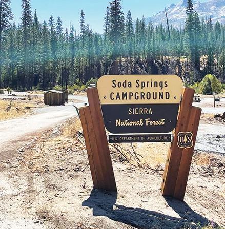

Soda Springs Campground on the Bass Lake Ranger District is open again.
Good news for campers and others as the Sierra National Forest continues to advance its large-scale efforts to reopen campgrounds, recreation sites, roads and trails this year and next.
Forest officials said the closures were the result of past fires and ongoing tree mortality.
The agency recently reopened three additional popular campgrounds on the Bass Lake Ranger District: Fish Creek, Soda Springs and Little Jackass. Officials said the campgrounds are fully rehabilitated, citing the completion of $2.17 million in contract work following the Creek Fire.
The new Forest Service order, which removes the three campgrounds from the closed list, took effect Oct. 9. The campgrounds were accepted for full operation next season.
Restoration work is still planned for the following sites, roads and trails:
• Closed forest developed recreation sites on the Bass Lake Ranger District include Crane Valley Campground, Dirt Flat Campground, Dry Gulch Campground, Rock Creek Campground and Texas Flat Group Campground.
• Closed forest developed recreation sites on the High Sierra Ranger District include Black Rock Campground, Gigantea Campground and Sawmill Flat Campground.
• Closed forest roads on the Bass Lake Ranger District include Road No. 4S17, Greens Mill (between its intersections with Chowchilla Mountain Road and Forest Road No. 4S17H) and Road No. 8S38Y Crosshatch.
• Closed forest roads on the High Sierra Ranger District include 7S05 Stump Springs (between Huntington Lake Road and West Kaiser Campground), 8208 Old Railroad Grade, 9S03 Dawn and 9S22 Music Mtn. Cutoff.
• Closed forest trails on the Bass Lake Ranger District include Trail No. 22E06 Shadow of the Giants, 24E13 Timber Creek, 25E01 Stevenson Trail: Hemlock Crossing Bridge closed and 26E63 Miller’s Crossing.
Officials said additional features would come off the closed list and be available for public use in “the weeks to come.” The full order and a high resolution map of the affected areas is available for viewing at www.fs.usda.gov/





Responses (0)