


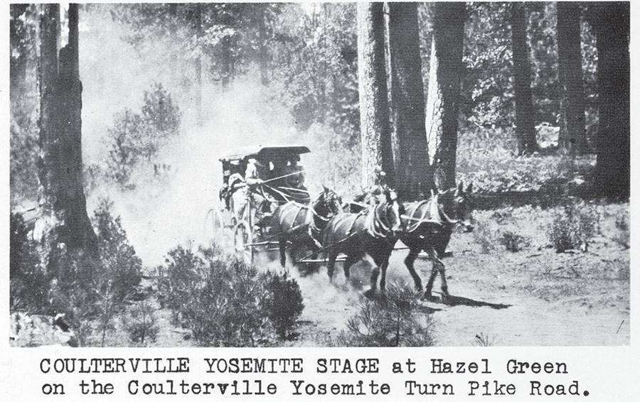

This is a photo from the Fiske family album and shows the Coulterville Yosemite Stage at Hazel Green on the Coulterville Yosemite Turn Pike.
Sorry to hear the county vacated its interest in 2012 with respect to the historic 1874 Coulterville-Yosemite Toll Road (Mariposa Gazette 9-12-26).
The Coulterville-Yosemite Toll Road was the first stagecoach road into Yosemite Valley, an incredible feat given the rugged terrain, and the source of many stories of adventures along the way.
My father’s family has lived in the Coulterville-Greeley Hill area since the mid-1800s and still does. He was also a local historian of the area, active in the Northern Mariposa County History Center. He regaled us kids with pictures of the early stagecoaches barreling along the Coulterville Yosemite Toll Road to the Hazel Green stage stop, and Ray Campbell driving the stage in 1897 on the precipitous Toll road, with Gov. James Budd riding in the coach.
The former Jeffrey Hotel in Coulterville has the signature of President Teddy Roosevelt who in its ledger, passed through there on his way into Yosemite a few years later.
The road is a historic roadway and the history of the road and the construction should be preserved and described — it’s part of California’s history.
Halfway through the construction, the owner’s “exclusive contract” to build the road was revoked by (presumably) the legislature in Sacramento, forcing the owner, who sank his personal money into building the road, into competition with the Big Oak Flat Road, ultimately losing all the money his firm invested in the road into Yosemite.
Big Oak Flat Road became the favored route and became Highway 120. This led to Groveland becoming a “stage stop” on the way into Yosemite and relegating Coulterville to almost “ghost town” status by the 1920s.
After reading an article about the unfortunate circumstances and the gradual abandonment of the Coulterville Road in a California historic journal, my friends and I set off in 2011 determined to follow the Old Coulterville Road to find the Hazel Green stage stop and see how far we could get into Yosemite, or even if we could cross into Yosemite at Hazel Green.
We heard it was a rough road — local knowledge around Greeley Hill. We started in Greeley Hill, where the Old Coulterville Road turns off the county road, continued by Bower’s Cave and the historic marker. The road narrowed.
The closer we got to Hazel Green, our high-carriage-four-wheel-drive Jeep straddled downed tree trunks, and the passenger side wheels pretty much stayed on the eroded shoulders and rutted road. It was barely a road, more of a trail.
By then, we followed mostly forest service roads using our 2011 topographical map. We found Hazel Green, which looked to be a newly renovated cabin, clearly labeled “Hazel Green,” but not open for business and not a soul around.
By then, we wanted a stage stop! We found the locked gate that kept us from following it into Yosemite; and found a way to get to Highway 120 (only a few miles) to avoid going back over the same remnant roads at night.
I see in the Mariposa Gazette that the county is planning a 100th anniversary of Highway 140. OK, what?
The 150th anniversary of both the Coulterville and the Big Oak Flat roads has just passed! What about Northern Mariposa County and the history of the two toll roads into Yosemite in 1874, and the impacts on communities along those roads?
Mariposa County has interests in the Old Coulterville Road, one of the two historical contenders for access to the high country of Yosemite. I realize that Tuolumne County has an interest as well, and perhaps there could be a joint anniversary involving Groveland and Coulterville — and Mariposa as the crown “Gateway Community.”
What will remain of the Coulterville-Yosemite Road and the history of Hazel Green and the stagecoaches that passed through?
It’s hard to tell what a 600-foot or 200-foot access road (and development) into Yosemite would mean for the historic nature of Hazel Green and the Coulterville Road. It probably means the history’s drifting away into records and nooks and crannies of archives.
It certainly would mean privileged access directly into the park (without an entry station?) for the visitors who would stay at the lodge and potential employee housing.
It would certainly not alleviate car traffic in the valley floor, unless the lodge will have its own shuttle bus down to the valley, and then there’s the construction traffic as well. And it will set a precedent for land swaps that cut into national parks and privilege only wealthier patrons and businesses.
It will be an end-run around Congress. The county needs to re-assert its interest in the land and monitor the promises of the developer closely — how much new employment in what kinds of jobs? How much housing for NPS employees? How will the environmental impacts of construction be mitigated — where will the electricity come from and will it affect the rates of Mariposa County residents? Will the lines be underground to mitigate wildfire possibilities? And what about water? Will it be wells, which will draw down water tables, and who will pay for the provision of such services?
Ultimately, the developer should arrange a land swap with Stanislaus National Forest for an access road over to 120. The USFS is a much more amenable land-swapper than NPS, and the tenants and renters will just have to enter through the 120 entryway at Crane Flat.
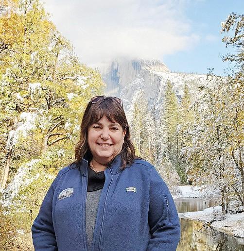
Shirley Fiske is a resident of Santa Fe, N.M., who also has property in Greeley Hill.


Responses (0)