


Shown is the bridge crossing the San Joaquin River Gorge called “Walk and Hoof Bridge.”
With winter snow within our grasp, and those of us who enjoy hiking, maybe we should be looking for lower elevation areas to hike.
One such area located along the San Joaquin River Gorge has a few choices of trails.
This column will introduce you to a hike along the east side of the San Joaquin River.
First, we’ll cross to the west side of the river by the steel foot bridge. At the first trail junction, we’ll follow downstream to a beach area strewn with driftwood.
From Oakhurst drive toward North Fork on Road 426, to Road 223, to Road 221, turn left on Road 200, turn right on Road 222 (Auberry Road).
Then continue down past Kerckhoff Lake and drive up in elevation to Auberry until you see Smalley Road on the right. Now follow down Smalley Road to the parking area on the right next to the trailhead.
Keep in mind there is a fee for parking, but if you have a national park pass, no fee is charged.
On this trip, I met a few seasoned hikers for this 8.4 mile round trip that drops down to and across the foot and hoof bridge that spans the San Joaquin River.

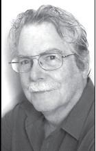
Tony Krizan
Once across the bridge, we’ll hike almost a mile to intersect the River Trail at the second junction. This left turn follows downstream but first it climbs a ways up the canyon wall, then descending to a beach only a mile from the upper end of Millerton Lake.
When crossing this foot bridge, our eyes can follow this natural gorge upstream as gravity forces the mountain water runoff through volcanic rock.
Upstream on the right is one of the PG&E power plants that regulate the water flow through the seasons. Looking downstream, we get our first view of our scenic route today.
Once intersecting the River Trail at the second trail junction, after 10 minutes focus your attention across the river at an elevated ridge. This ridge called Squaw Leap (area namesake) comes into view.
Its steep cliff on the north face is the location of this American Indian legend. Legend has it that a young Indian girl’s family betrothed her to a warrior from another tribe to whom she fell in love with.

Looking upstream from bridge at PG&E power station.
This warrior ignored this proposal and married another Indian girl. She (Sotuka) was heartbroken and cast herself off the north face of this mountain.
On our trailside directly above us is Kenney Flat, another elevated area following the western ridge line. Soon we’ll cross a small stream and a small signed viewpoint that overlooks the river.
Continuing downstream, the trail eventually descends to the river opening up a beach area strewn with driftwood. Looking at the surrounding area, I could see water marks from the drastic change of water level.
This area drops in elevation to 570 feet. Amazing how the San Joaquin River changes in water level from season to season. This will be our turnaround point for our return to the trailhead.
As we were departing, a sound off in the distance I could hear the emergency siren blowing to signal a warning for those downstream that the water level would be rising. I said to myself thanks for the warning but we’ll be at higher ground before they adjust the flood gates.

Looking downstream from bridge.
Now keep in mind that this hike is considered a reverse hike which means our return trek will be mostly an increase in elevation. The most strenuous area on our return will be after crossing the bridge.
The bridge elevation is 720 feet and the trailhead is 1,020 feet. This hike should take under four hours to complete.
Another optional hike in the same area, once you cross the bridge, is to continue hiking straight past the second junction point.
This will be a loop hike called the west branch of the Ridge Trail. It follows the ridge line above the previous trail mentioned.
This is a six mile trek following back to the bridge crossing and trailhead.
Before we started this trek there was an unwelcomed guest hiking this trail before us. His identity was exposed by looking at his tracks on the trail.

Black bear tracks on hiking trail leading down river.
Yes, they were black bear tracks over seven inches in length.
There you have two winter hikes within the same area and I guarantee you will not be disappointed. See you on the trail!
Tony Krizan describes himself as an “adventurer” and he explores the Sierra Nevada range on a regular basis. He can be reached at tonykrizan@hotmail.com.

Hiking trail leading up to trailhead from bridge.

From the trail looking into valley downstream at lower PG&E power station. It is only one mile


Responses (0)